
Assessment of Urban Encroachment Using High-Resolution Satellite Imagery and Advanced Change Detection Techniques A Case Study of Lake Maryut, Alexandria, Egypt (2002–2025)
DOI:
https://doi.org/10.59543/qythq794Keywords:
Lake Maryut; Change detection; Cross tabulation; Temporal dynamics; UrbanizationAbstract
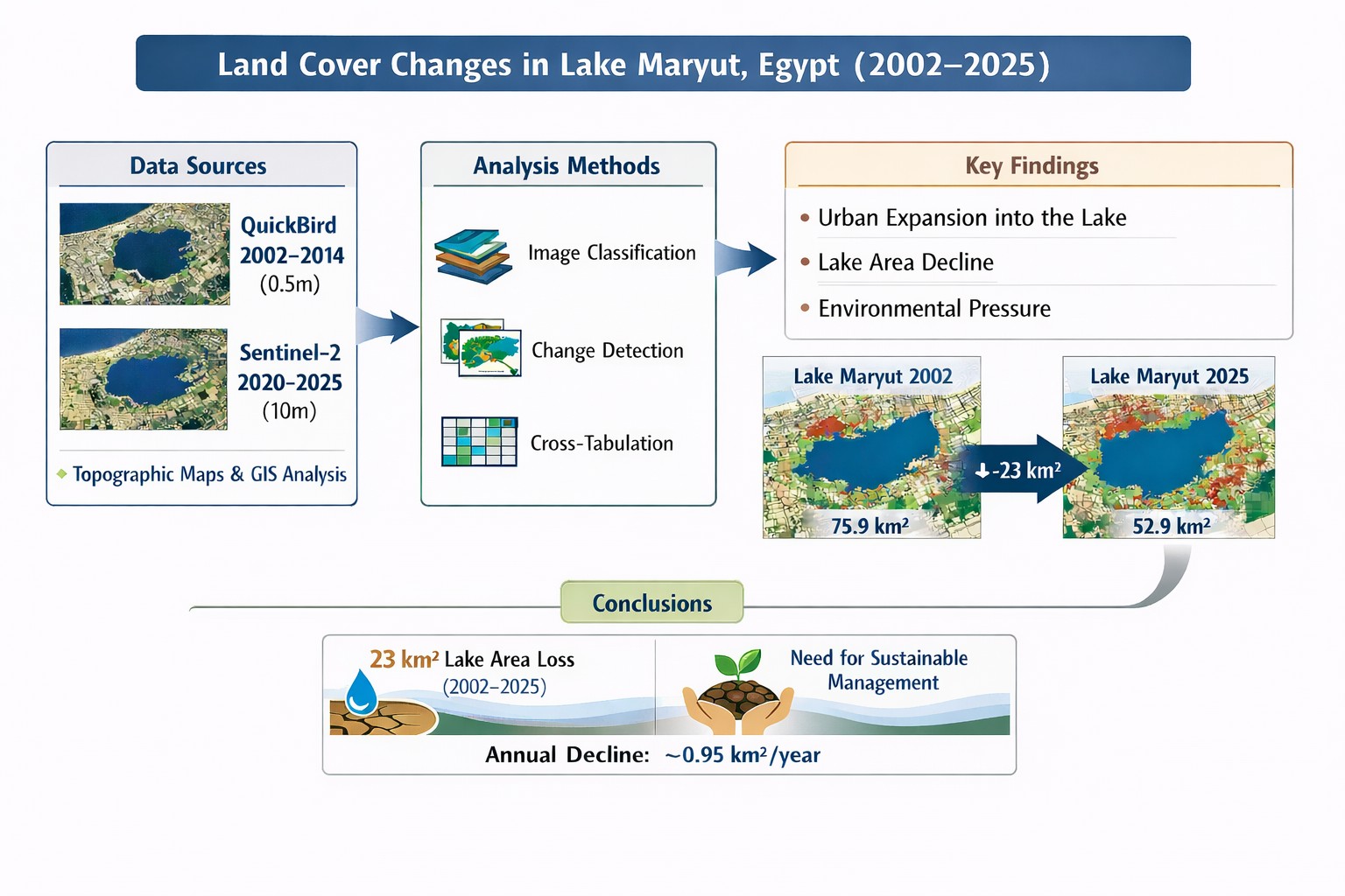
Accurate and up-to-date information on land cover and land use, along with their temporal dynamics, is essential for producing reliable land cover maps and supporting ecosystem monitoring, urban planning, policy development, and resource management. This study assesses land cover changes in Lake Maryut, south of Alexandria, Egypt, from 2002 to 2025, a period marked by significant socio-political shifts following the 2011 revolution. High-resolution QuickBird imagery (0.5 m; 2002–2014) and medium-resolution Sentinel-2 imagery (10 m; 2020–2025) were integrated with topographic maps, remote sensing techniques, and Geographic Information System (GIS) analysis to detect and quantify spatial transformations. Change detection was performed using a post-classification comparison approach supported by cross-tabulation for pixel-based assessment. The results reveal substantial urban encroachment into agricultural land and wastewater infrastructure, contributing to notable environmental pressures on the lake. The lake’s surface area declined from 75.9 km² in 2002 to 69.5 km² in 2014, 67.8 km² in 2020, and 52.9 km² in 2025, amounting to a total loss of approximately 23 km² at an average annual reduction rate of 0.95 km². These findings underscore the pressing need for targeted management strategies to mitigate ongoing environmental degradation and foster sustainable development in the region.
Downloads
Published
How to Cite
Issue
Section
License
Copyright (c) 2026 Neama Hussen Selim Ali, Mohamed Ezz El Din El Raey (Author)

This work is licensed under a Creative Commons Attribution 4.0 International License.